

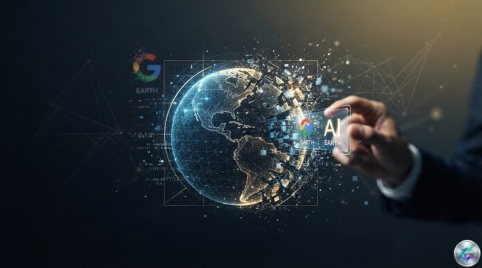
Google has pulled its ‘create image’ tool in Google Earth less than 48 hours after launch, a feature that overlaid AI-generated images on top of authentic satellite data. The swift reversal highlights the widening gap between generative capabilities and safeguards against visual disinformation.
🔑 Key takeaways
- Launch date: Thursday, July 31, 2026, on Google Earth (web)
- Pull date: Friday, August 1, 2026, less than 48 hours later
- Underlying model: Nano Banana 2, Google’s image generator
- SynthID watermark shown to be bypassable by BBC Verify and AI detection researchers
- Documented misuses included a burning Kharg Island, a flooded Capitol, a Los Angeles crater and tanks in Kyiv
A Lightning-Fast Launch and a Swift Reversal
On Thursday, July 31, 2026, Google activated a new feature dubbed ‘create image’ in Google Earth on the web. The workflow was deceptively simple: a user zooms in on any location, clicks a button, types a text prompt and receives a photorealistic AI-generated image overlaid on the platform’s real satellite, aerial and 3D mapping data. The underlying engine was Nano Banana 2, Google’s latest image generation model.
Less than 48 hours later, Google reversed course. The company explained the decision in a statement posted on X, citing both useful professional use cases and violations of its internal policies.
“We know people put particular trust in Google Earth for a reliable view of the world. We saw geospatial professionals use this feature for a variety of useful applications. However, we also saw people sharing screenshots of generated images that appeared to violate our policies.”
Google, official statement
Documented Misuses Within Hours
The speed of the proliferation caught even seasoned observers off guard. Open-source researcher Henk van Ess, the first to flag the tool’s dangers, told NPR he had submitted prompts involving refugees at the US-Mexico border, a nuclear power plant in Iran, a crash in Amsterdam and a hospital with a bomb crater in Gaza. According to his tests, ‘nothing was refused.’
Several outlets reproduced and documented these abuses. NPR generated images of Iran’s Kharg Island on fire and a flooded US Capitol complex, both events that never happened but would constitute major news if real. 404 Media showed it could produce an explosion crater in Los Angeles and add fictional protesters to Google’s Mountain View campus. BBC Verify, for its part, obtained images of a collapsed Eiffel Tower, a sinkhole swallowing the Great Pyramid of Giza and Russian tanks in the streets of Kyiv.
| Outlet | Type of fake generated | Location |
|---|---|---|
| NPR | Island on fire | Kharg (Iran) |
| NPR | Flooded Capitol | Washington D.C. |
| 404 Media | Explosion crater | Los Angeles |
| 404 Media | Protesters | Mountain View (Google HQ) |
| BBC Verify | Collapsed Eiffel Tower | Paris |
| BBC Verify | Sinkhole over pyramid | Giza (Egypt) |
| BBC Verify | Russian tanks | Kyiv (Ukraine) |
The Specific Risk of Satellite Deepfakes
Henk van Ess offered a particularly alarming diagnosis of the threat. In his view, the tool does not merely generate fake images — it anchors them to real geographic coordinates, lending them extra credibility.
“Google allowed invented images to be welded onto authentic coordinates, drawn over authentic imagery. The fake does not need to look convincing on its own. It inherits the credibility of the map it was born on.”
Henk van Ess, open-source researcher, to BBC Verify
Jake Godin, senior researcher at Bellingcat, warned against the streamlining of the fabrication process. ‘It is simply a rationalization of the process, which I think will make it proliferate further,’ he told NPR. He added that ‘disinformation travels further and faster than any form of correction’ and that governments could now invoke forgery to dismiss authentic satellite imagery in a strategy of systematic doubt.
Bill Greer, geospatial analyst and co-founder of the non-profit satellite service Common Space, agreed in comments to BBC Verify. He stressed that satellite imagery has historically been perceived as a particularly reliable data source, which makes its forgery all the more damaging. He also noted that several governments are already restricting access to real data — a trend that, combined with the multiplication of fakes, risks durably eroding public trust.
The SynthID Watermark Deemed Insufficient
At launch, Google had defended its tool by pointing to several layers of protection. Each generated image was stamped with the SynthID digital watermark, designed to flag the content as AI-generated in other Google tools such as Gemini. The company also said it prevented the creation of images depicting harmful subjects and noted that the renders did not appear in the main Google Earth experience for other users.
Those assurances quickly came apart. BBC Verify found that Gemini could be tricked into declaring that the fake Google Earth images were real. Several external AI detection tools likewise failed to flag Google’s AI-generated content. Henk van Ess claimed he had fooled Hive’s AI detector with a video generated in Google Earth, illustrating how the media can spread despite the watermarks.
BBC Verify also showed that small wording changes in prompts were enough to bypass the built-in guardrails. An explicit request for an ‘elevated platform to hang traitors’ next to the UK Parliament was refused; a vaguer formulation was accepted and the corresponding image was produced.
A Gemini Precedent
This is not the first time Google has suspended an AI tool shortly after launch. In February 2024, the company disabled Gemini’s ability to generate images of people after the tool produced historically inaccurate depictions. That pause lasted several weeks before a partial and constrained return of the feature.
For now, Google has not said when, or in what revised form, the Google Earth image generation tool might be reinstated. The company simply stated it was working on ‘stronger safeguards.’
Conclusion
The Google Earth image generator episode illustrates the rapid erosion of a once-solid regime of visual trust. Satellite imagery enjoyed a status close to factual self-evidence: what was seen from space was, by construction, hard to tamper with. The ability to generate a credible, geolocated and nearly undetectable fake in seconds overturns that presumption.
Several scenarios lie ahead. The most likely is the tool’s return after reinforced prompt filters, internal classifiers and stronger watermarks. The most troubling is the one Bill Greer outlined: a gradual erosion of trust in satellite imagery, coupled with restricted access to authentic data, creating a ‘truth gap’ in which no image can be taken at face value. For open-source investigators, journalists and NGOs documenting conflict zones, Google’s retreat is but one episode — but it marks a step in the race between generation and detection.
Sources
This article is published for informational and educational purposes only. It does not constitute investment advice. Do your own research (DYOR) before making any decision.

